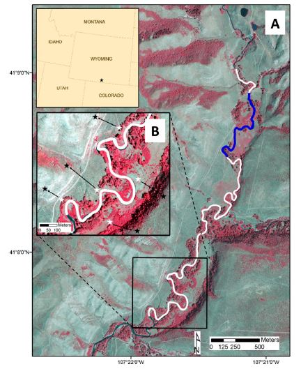
This picture shows a color-infrared NAIP image of Savery Creek in Wyoming, USA that was used as a test site study site for quantifying spatial variations in image registration error. The image is included in a 2016 peer-reviewed paper with Carl Legleiter in the journal Geomorphology called “Refining measurements of lateral channel movement from image time series by quantifying spatial variations in registration error”.
Data
The National Agricultural Imagery Program (NAIP) photo used was part of a set for the state of Wyoming that I acquired for this project via the Wyoming Geospatial Consortium.
Tools Used
- ArcMap
- ENVI
- Microsoft Powerpoint
