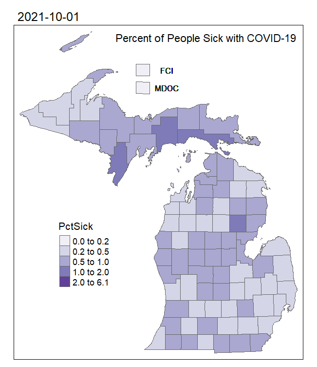
I created this GIF to show the approximate percent of people per Michigan county (or equivalent unit, as FCI and MDOC stand for Federal Correctional Institution and Michigan Department of Corrections, respectively) that were sick with COVID-19 over time. While there is data to do so, creating a GIF from the beginning of recorded COVID-19 infections in March 2020 and present would be a very large file, so I subset this data into a six-month period to show here.
Data
The daily COVID-19 infection data per county were acquired from https://www.michigan.gov/coronavirus/stats
The county polygons were downloaded from the US Census Bureau, and the county population numbers to calculate percentage sick were estimates from the 2020 American Community Survey.
For full project details how I produced this map from inception to completion, please see the project details .txt file on my GitHub: https://github.com/devinmlea/MapsAndCode/tree/main/2022/MIPctSickCOVID
Tools Used
- Microsoft Excel
- ArcGIS Pro
- R
