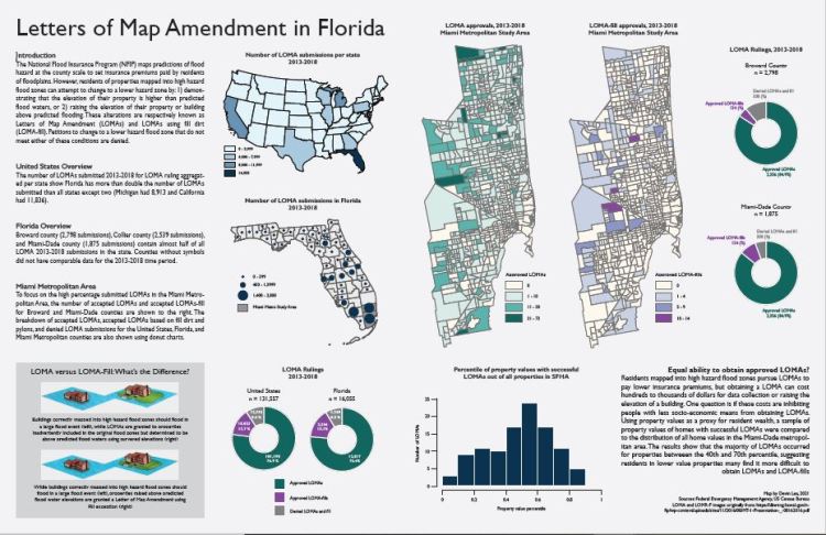
I created this data graphic related to my dissertation research and as the final project for an Advanced Cartography class I took in spring 2021. The graphic shows the distribution of Letters of Map Amendment on National Flood Insurance Program flood maps from US wide scaling down into Florida. Letters of Map Amendment are buildings initially mapped into high hazard flood zones but later found exempt of the requirements of insurance in those zones; my dissertation investigated the spatial distribution and implications of Letters of Map Amendments across the United States.
Data
I acquired and cleaned the Letter of Map Amendment data from the FEMA flood map service center website. The state, county, and census tract scale shapefile layers were downloaded from the US Census Bureau. Property value data were obtained from the Florida Department of Revenue.
Tools Used
- ArcGIS
- R
- Python
- Adobe Illustrator
