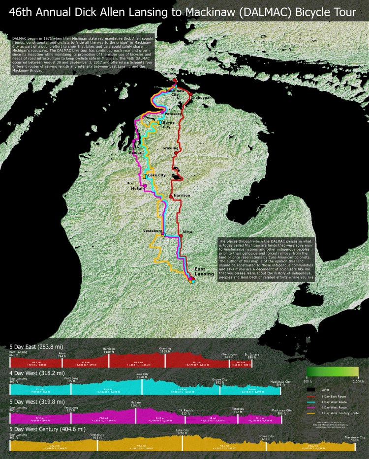
I created this map for fun to show the routes and elevation profiles for the various routes a cyclist could complete as part of the 2017 DALMAC bike tour.
Data
The background Digital Elevation Model came from USGS Earth Explorer. The route data and elevation profiles were acquired from ridewithgps.com.
For more detailed information how I produced this map, please see the detailed project notes on my GitHub:
https://github.com/devinmlea/MapsAndCode/tree/main/2022/DALMAC2017
Tools Used
- Microsoft Excel
- QGIS
- Python
- Adobe Photoshop + Illustrator
